
Jerantut topographic map
Interactive map
Click on the map to display elevation.
About this map
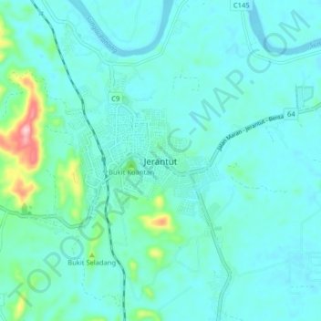
Name: Jerantut topographic map, elevation, terrain.
Location: Jerantut, Pahang, Malaysia (3.89666 102.33196 3.97666 102.41196)
Average elevation: 74 m
Minimum elevation: 41 m
Maximum elevation: 276 m