
Harrogate topographic map
Interactive map
Click on the map to display elevation.
About this map
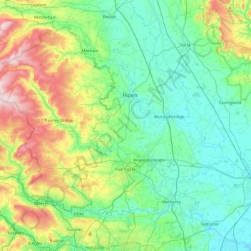
Name: Harrogate topographic map, elevation, terrain.
Average elevation: 131 m
Minimum elevation: 4 m
Maximum elevation: 568 m
Other topographic maps
Click on a map to view its topography, its elevation and its terrain.
Birstwith
United Kingdom > England > Harrogate > Birstwith
Birstwith, Harrogate, North Yorkshire, Yorkshire and the Humber, England, HG3 2NN, United Kingdom
Average elevation: 125 m