
Thank you for supporting this site ❤️
Make a donation
Make a donation
Lusk topographic map
Click on the map to display elevation.
Thank you for supporting this site ❤️
Make a donation
Make a donation
About this map
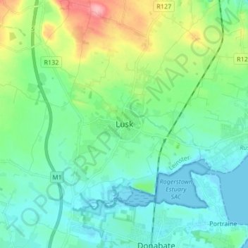
Name: Lusk topographic map, elevation, terrain.
Location: Lusk, Fingal, County Dublin, Leinster, K45 K650, Ireland (53.48558 -6.20581 53.56558 -6.12581)
Average elevation: 26 m
Minimum elevation: -1 m
Maximum elevation: 107 m
Thank you for supporting this site ❤️
Make a donation
Make a donation