
Karlskrona topographic map
Interactive map
Click on the map to display elevation.
Karlskrona
When the city was founded in 1680, it was primarily thought of as a military city, with many defenses and fortifications exploiting the particular topography of the city. Some fortifications were located on the main island (Trossö) such as the Bastion Aurora, built at the beginning of the 18th century, but much of it was located on the nearby islands (Ljungskär, Mjölnareholmen, Godnatt, Koholmen and Kurrholmen) or more distant, such as the islands closing the bay, with in particular the important fortress of Kungsholmen and its circular port.
About this map
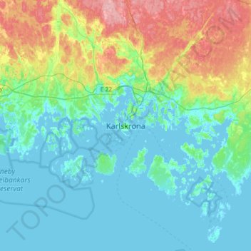
Name: Karlskrona topographic map, elevation, terrain.
Location: Karlskrona, Karlskrona kommun, Blekinge County, 37131, Sweden (56.00211 15.42664 56.32211 15.74664)
Average elevation: 25 m
Minimum elevation: -3 m
Maximum elevation: 113 m