
Camarin topographic map
Interactive map
Click on the map to display elevation.
About this map
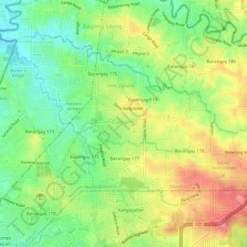
Name: Camarin topographic map, elevation, terrain.
Location: Camarin, District 1, Caloocan, Metro Manila, Philippines (14.73806 121.02676 14.77327 121.07793)
Average elevation: 68 m
Minimum elevation: 30 m
Maximum elevation: 113 m
Other topographic maps
Click on a map to view its topography, its elevation and its terrain.
Balintawak
Balintawak, District 2, Caloocan, Northern Manila District, Metro Manila, Philippines
Average elevation: 22 m
Bagumbong
Bagumbong, Zone 15, District 1, Caloocan, Northern Manila District, Metro Manila, 1421, Philippines
Average elevation: 45 m
Barangay 41
Barangay 41, Zone 4, Grace Park West, District 2, Caloocan, Northern Manila District, Metro Manila, Philippines
Average elevation: 13 m