
Naseby topographic map
Interactive map
Click on the map to display elevation.
About this map
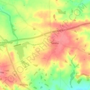
Name: Naseby topographic map, elevation, terrain.
Location: Naseby, West Northamptonshire, England, United Kingdom (52.37167 -1.02708 52.41919 -0.95535)
Average elevation: 165 m
Minimum elevation: 117 m
Maximum elevation: 203 m
Other topographic maps
Click on a map to view its topography, its elevation and its terrain.
Silverstone
United Kingdom > England > West Northamptonshire
Silverstone, West Northamptonshire, England, United Kingdom
Average elevation: 133 m