
Lake Brunner topographic map
Interactive map
Click on the map to display elevation.
About this map
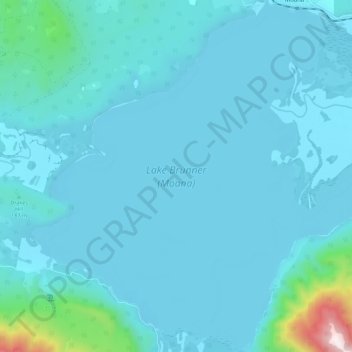
Name: Lake Brunner topographic map, elevation, terrain.
Average elevation: 168 m
Minimum elevation: 80 m
Maximum elevation: 1,184 m
Lake Brunner is the largest lake in the West Coast region, 10 km (6.2 mi) across with an area of 4061 ha, just over 40 km2 (15 sq mi). The outlet of the lake is the Arnold River, a tributary of the Grey River / Māwheranui, next to the largest settlement of Moana, on the north shore of the lake. The largest rivers feeding into Lake Brunner are the Crooked River from the east, the Orangipuku River and Bruce Creek from the south at Swan Bay, and the Eastern Hohonu River from the west at Hohonu Spit. It is 31 km southwest of Greymouth, at an altitude of 76 m. Two small islands in Pah Bay near the mouth of the Crooked River are known as the Refuge Islands (Takataka and Takatakaiti).