
Snowdon topographic map
Interactive map
Click on the map to display elevation.
About this map
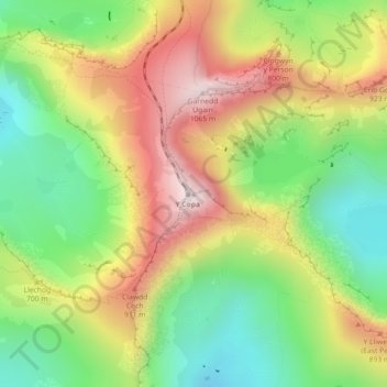
Name: Snowdon topographic map, elevation, terrain.
Average elevation: 692 m
Minimum elevation: 390 m
Maximum elevation: 1,061 m
Snowdon (/ˈsnoʊdən/; Welsh: Yr Wyddfa, pronounced ) is the highest mountain in Wales, at an elevation of 1,085 metres (3,560 ft) above sea level, and the highest point in the British Isles outside the Scottish Highlands. It is located in Snowdonia National Park (Parc Cenedlaethol Eryri) in Gwynedd (historic county of Caernarfonshire). It is the busiest mountain in the United Kingdom and the third most visited attraction in Wales; in 2019 it was visited by 590,984 walkers, with an additional 140,000 people taking the train. It is designated as a national nature reserve for its rare flora and fauna.