
Awatere River topographic map
Interactive map
Click on the map to display elevation.
About this map
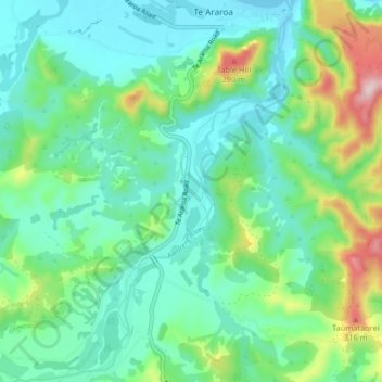
Name: Awatere River topographic map, elevation, terrain.
Location: Awatere River, Te Araroa, Gisborne, New Zealand (-37.69557 178.31954 -37.63115 178.37776)
Average elevation: 89 m
Minimum elevation: 0 m
Maximum elevation: 357 m
Other topographic maps
Click on a map to view its topography, its elevation and its terrain.