
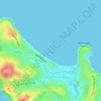
Stanmore Bay topographic map
Interactive map
Click on the map to display elevation.
About this map
Name: Stanmore Bay topographic map, elevation, terrain.
Average elevation: 18 m
Minimum elevation: 0 m
Maximum elevation: 96 m
Other topographic maps
Click on a map to view its topography, its elevation and its terrain.
Torbay
New Zealand > Auckland > Hibiscus Coast
Torbay, Hibiscus Coast, Hibiscus and Bays, Auckland, New Zealand, Waiake Beach
Average elevation: 19 m
Red Beach
New Zealand > Auckland > Hibiscus Coast
Red Beach, Hibiscus Coast, Hibiscus and Bays, Auckland, New Zealand
Average elevation: 12 m
Shakespear Regional Park
New Zealand > Auckland > Hibiscus Coast
Shakespear Regional Park, Hibiscus Coast, Hibiscus and Bays, Auckland, New Zealand
Average elevation: 24 m