
Spittal an der Drau topographic map
Interactive map
Click on the map to display elevation.
About this map
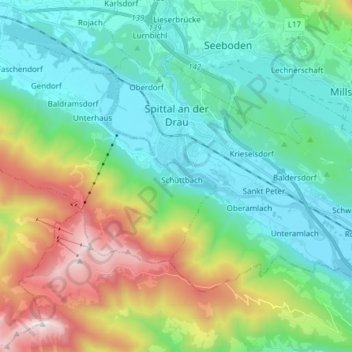
Name: Spittal an der Drau topographic map, elevation, terrain.
Location: Spittal an der Drau, Carinthia, 9800, Austria (46.74404 13.46602 46.81588 13.61911)
Average elevation: 969 m
Minimum elevation: 514 m
Maximum elevation: 2,185 m