
Yangdong District topographic map
Interactive map
Click on the map to display elevation.
About this map
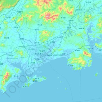
Name: Yangdong District topographic map, elevation, terrain.
Location: Yangdong District, Yangjiang City, Guangdong, PRC (21.44664 111.76381 22.26494 112.36487)
Average elevation: 55 m
Minimum elevation: -5 m
Maximum elevation: 997 m
Other topographic maps
Click on a map to view its topography, its elevation and its terrain.