
Stafford Heights topographic map
Interactive map
Click on the map to display elevation.
About this map
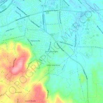
Name: Stafford Heights topographic map, elevation, terrain.
Location: Stafford Heights, Dauphin County, Pennsylvania, 17033, USA (40.23926 -76.66386 40.27926 -76.62386)
Average elevation: 152 m
Minimum elevation: 115 m
Maximum elevation: 248 m