
Shute Harbour topographic map
Interactive map
Click on the map to display elevation.
About this map
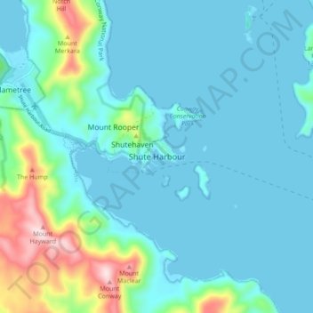
Name: Shute Harbour topographic map, elevation, terrain.
Location: Shute Harbour, Queensland, Australia (-20.32964 148.74876 -20.24964 148.82876)
Average elevation: 69 m
Minimum elevation: 0 m
Maximum elevation: 422 m