
Ville de Saguenay topographic map
Interactive map
Click on the map to display elevation.
About this map
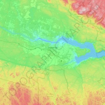
Name: Ville de Saguenay topographic map, elevation, terrain.
Location: Ville de Saguenay, Saguenay - Lac-Saint-Jean, Quebec, Canada (48.18773 -71.56377 48.56627 -70.68734)
Average elevation: 259 m
Minimum elevation: 0 m
Maximum elevation: 975 m