
Holyhead topographic map
Interactive map
Click on the map to display elevation.
About this map
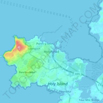
Name: Holyhead topographic map, elevation, terrain.
Location: Holyhead, Isle of Anglesey, Wales, LL65 1UN, United Kingdom (53.27067 -4.67310 53.35067 -4.59310)
Average elevation: 10 m
Minimum elevation: -1 m
Maximum elevation: 217 m
Other topographic maps
Click on a map to view its topography, its elevation and its terrain.