
Area F (Cherry Creek) topographic map
Interactive map
Click on the map to display elevation.
About this map
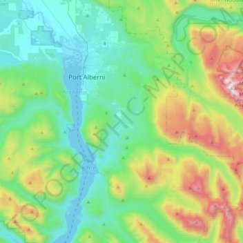
Name: Area F (Cherry Creek) topographic map, elevation, terrain.
Average elevation: 457 m
Minimum elevation: 0 m
Maximum elevation: 1,780 m
Other topographic maps
Click on a map to view its topography, its elevation and its terrain.
Alberni Inlet China Creek Woodlands
Canada > British Columbia > Area F (Cherry Creek)
Alberni Inlet China Creek Woodlands, Area F (Cherry Creek), Alberni-Clayoquot Regional District, British Columbia, Canada
Average elevation: 537 m