
Kamrup topographic map
Interactive map
Click on the map to display elevation.
About this map
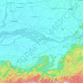
Name: Kamrup topographic map, elevation, terrain.
Location: Kamrup, Assam, India (25.72350 90.93551 26.49769 91.82193)
Average elevation: 164 m
Minimum elevation: 31 m
Maximum elevation: 1,281 m
Other topographic maps
Click on a map to view its topography, its elevation and its terrain.