
Mitiaro topographic map
Interactive map
Click on the map to display elevation.
About this map
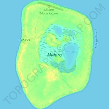
Name: Mitiaro topographic map, elevation, terrain.
Location: Mitiaro, Cook Islands (-19.89732 -157.72345 -19.83934 -157.67948)
Average elevation: 6 m
Minimum elevation: -1 m
Maximum elevation: 23 m
Other topographic maps
Click on a map to view its topography, its elevation and its terrain.