
Waitahanui topographic map
Interactive map
Click on the map to display elevation.
About this map
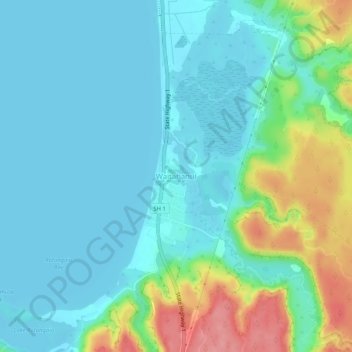
Name: Waitahanui topographic map, elevation, terrain.
Location: Waitahanui, Taupo District, Waikato, New Zealand (-38.80991 176.05823 -38.76991 176.09823)
Average elevation: 380 m
Minimum elevation: 356 m
Maximum elevation: 460 m
Other topographic maps
Click on a map to view its topography, its elevation and its terrain.
Lake Rotongaio
New Zealand > Waikato > Waitahanui
Lake Rotongaio, Rotongaio Road, Waitahanui, Taupo District, Waikato, New Zealand
Average elevation: 403 m