
Cereme topographic map
Interactive map
Click on the map to display elevation.
About this map
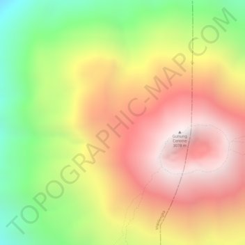
Name: Cereme topographic map, elevation, terrain.
Location: Cereme, Majalengka Regency, West Java, Indonesia (-6.89205 108.39995 -6.89195 108.40005)
Average elevation: 2,572 m
Minimum elevation: 1,969 m
Maximum elevation: 3,043 m
Other topographic maps
Click on a map to view its topography, its elevation and its terrain.
Rangkapan Jaya
Indonesia > West Java > Bogor > Depok
Rangkapan Jaya, Pancoran Mas, Depok, Bogor, West Java, Indonesia
Average elevation: 87 m
Pasir Lugay
Pasir Lugay, Gardu, West Java, 41175, Indonesia
Average elevation: 483 m
Kersamanah
Indonesia > West Java > Kersamanah
Kersamanah, West Java, Indonesia
Average elevation: 584 m
Gunung Argapura
Gunung Argapura, Majalengka Regency, West Java, Indonesia
Average elevation: 1,831 m