
Ward County topographic map
Interactive map
Click on the map to display elevation.
About this map
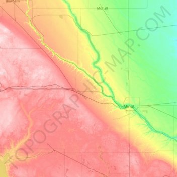
Name: Ward County topographic map, elevation, terrain.
Location: Ward County, North Dakota, USA (47.84681 -102.23593 48.80662 -100.96853)
Average elevation: 579 m
Minimum elevation: 443 m
Maximum elevation: 748 m
Other topographic maps
Click on a map to view its topography, its elevation and its terrain.
Boundary Lake
Boundary Lake, 23rd Avenue Northeast, Bottineau County, North Dakota, USA
Average elevation: 685 m