
Tata Islands topographic map
Interactive map
Click on the map to display elevation.
About this map
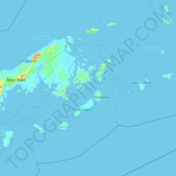
Name: Tata Islands topographic map, elevation, terrain.
Location: Tata Islands, Tandubas, Tawi-Tawi, BARMM, 7502, Philippines (4.84667 119.98000 5.48667 120.62000)
Average elevation: 3 m
Minimum elevation: -2 m
Maximum elevation: 342 m
Other topographic maps
Click on a map to view its topography, its elevation and its terrain.
Mantabuan Tabunan
Mantabuan Tabunan, Tawi-Tawi, Bangsamoro, Philippines
Average elevation: 4 m