
Westland Tai Poutini National Park topographic map
Interactive map
Click on the map to display elevation.
About this map
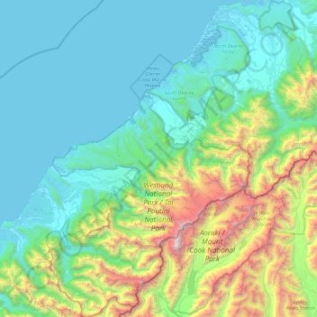
Name: Westland Tai Poutini National Park topographic map, elevation, terrain.
Average elevation: 685 m
Minimum elevation: -1 m
Maximum elevation: 3,676 m
Other topographic maps
Click on a map to view its topography, its elevation and its terrain.
Lake Mueller
Lake Mueller, Fox Glacier Highway, Fox Glacier, Westland District, West Coast, New Zealand
Average elevation: 402 m