
Lake Waitawa topographic map
Interactive map
Click on the map to display elevation.
About this map
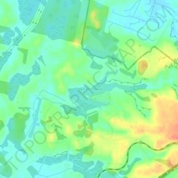
Name: Lake Waitawa topographic map, elevation, terrain.
Average elevation: 24 m
Minimum elevation: 7 m
Maximum elevation: 57 m
Other topographic maps
Click on a map to view its topography, its elevation and its terrain.
Ngatotara Lagoon
New Zealand > Wellington > Otaki
Ngatotara Lagoon, Taylors Road, Otaki, Kapiti Coast District, Wellington, 5512, New Zealand
Average elevation: 17 m
Lake Kopureherehere
New Zealand > Wellington > Otaki
Lake Kopureherehere, Forest Lakes Road, Otaki, Kapiti Coast District, Wellington, 5512, New Zealand
Average elevation: 22 m