
Boulder topographic map
Interactive map
Click on the map to display elevation.
About this map
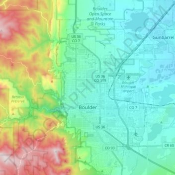
Name: Boulder topographic map, elevation, terrain.
Average elevation: 1,786 m
Minimum elevation: 1,560 m
Maximum elevation: 2,452 m
Boulder (/ˈboʊldər/) is the home rule municipality that is the county seat and the most populous municipality of Boulder County, Colorado, United States. It is the state's 11th-most-populous municipality; Boulder is located at the base of the foothills of the Rocky Mountains at an elevation of 5,430 feet (1,655 m) above sea level. The city is 25 miles (40 km) northwest of Denver.