
Thank you for supporting this site ❤️
Make a donation
Make a donation
Calcasieu Parish topographic map
Click on the map to display elevation.
Thank you for supporting this site ❤️
Make a donation
Make a donation
About this map
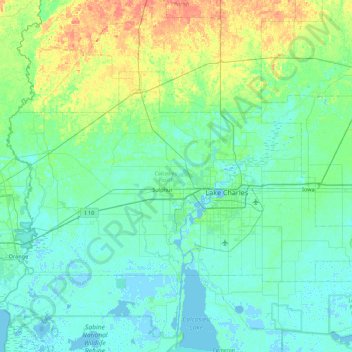
Name: Calcasieu Parish topographic map, elevation, terrain.
Location: Calcasieu Parish, Louisiana, United States (30.03820 -93.76609 30.49042 -92.88761)
Average elevation: 10 m
Minimum elevation: -5 m
Maximum elevation: 54 m
Thank you for supporting this site ❤️
Make a donation
Make a donation
Other topographic maps
Click on a map to view its topography, its elevation and its terrain.
Bayou Liberty Gardens
United States > Louisiana > St. Tammany Parish > Bayou Liberty Gardens
Average elevation: 6 m