
Bishah topographic map
Interactive map
Click on the map to display elevation.
About this map
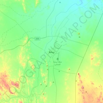
Name: Bishah topographic map, elevation, terrain.
Location: Bishah, 'Asir Province, Saudi Arabia (19.84000 42.44000 20.16000 42.76000)
Average elevation: 1,194 m
Minimum elevation: 1,113 m
Maximum elevation: 1,456 m
Bisha (Arabic: بيشة, Bīšah), also known as Qal`at Bishah (Arabic: قلعة بيشة, Qalʿat Bīšah), is a town in the south-western Saudi Arabian province, 'Asir. Bisha was its own province before merging with its neighboring province, 'Asir. Bisha has a population of 202,096 according to the 2022 Census in the governorate, with nearly 240 villages and 58 larger settlements that are spread out on both sides of the Bisha Valley (the longest valley in the Arabian Peninsula). The city is located to the south of the Arabian Peninsula, which is almost entirely under the administration of the Kingdom of Saudi Arabia. It stands at an altitude of approximately 610 meters (2,000 ft.) above sea level.
Other topographic maps
Click on a map to view its topography, its elevation and its terrain.