
Munkedals kommun topographic map
Interactive map
Click on the map to display elevation.
About this map
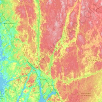
Name: Munkedals kommun topographic map, elevation, terrain.
Location: Munkedals kommun, Västra Götaland County, Sweden (58.39499 11.43754 58.81897 11.92207)
Average elevation: 97 m
Minimum elevation: -1 m
Maximum elevation: 205 m
Other topographic maps
Click on a map to view its topography, its elevation and its terrain.
Hedekas
Sweden > Västra Götaland County
Hedekas, Munkedals kommun, Västra Götaland County, 455 41, Sweden
Average elevation: 90 m
Tråvad
Sweden > Västra Götaland County > Vara kommun
Tråvad, Vara kommun, Västra Götaland County, 534 92, Sweden
Average elevation: 86 m
Vargön
Sweden > Västra Götaland County
Vargön, Vänersborgs kommun, Västra Götaland County, 468 33, Sweden
Average elevation: 74 m