
Moody topographic map
Interactive map
Click on the map to display elevation.
About this map
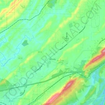
Name: Moody topographic map, elevation, terrain.
Location: Moody, St. Clair County, Alabama, 35004, United States (33.54938 -86.55192 33.64456 -86.43368)
Average elevation: 223 m
Minimum elevation: 161 m
Maximum elevation: 383 m
Other topographic maps
Click on a map to view its topography, its elevation and its terrain.
Ashville
United States > Alabama > St. Clair County
Ashville, St. Clair County, Alabama, 35953, United States
Average elevation: 190 m