
Banicain topographic map
Interactive map
Click on the map to display elevation.
About this map
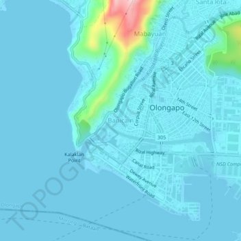
Name: Banicain topographic map, elevation, terrain.
Location: Banicain, Olongapo, Central Luzon, 2200, Philippines (14.80930 120.25556 14.84930 120.29556)
Average elevation: 17 m
Minimum elevation: -1 m
Maximum elevation: 225 m
Other topographic maps
Click on a map to view its topography, its elevation and its terrain.
Driftwood Beach Resort
Philippines > Olongapo > Barretto
Driftwood Beach Resort, Barretto, Olongapo, Central Luzon, 2200, Philippines
Average elevation: 49 m