
Phrae Province topographic map
Interactive map
Click on the map to display elevation.
About this map
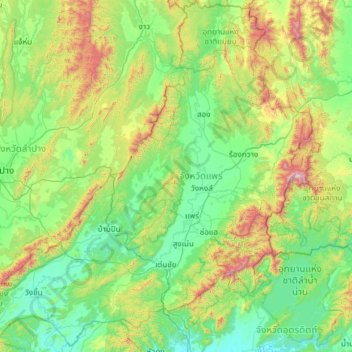
Name: Phrae Province topographic map, elevation, terrain.
Location: Phrae Province, Thailand (17.67638 99.31026 18.83457 100.54221)
Average elevation: 384 m
Minimum elevation: 66 m
Maximum elevation: 1,638 m