
Thank you for supporting this site ❤️
Make a donation
Make a donation
Round Lake topographic map
Click on the map to display elevation.
Thank you for supporting this site ❤️
Make a donation
Make a donation
About this map
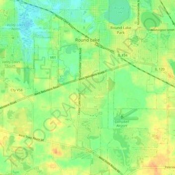
Name: Round Lake topographic map, elevation, terrain.
Location: Round Lake, Lake County, Illinois, 60073, United States (42.30337 -88.14827 42.36800 -88.08258)
Average elevation: 241 m
Minimum elevation: 225 m
Maximum elevation: 259 m
Thank you for supporting this site ❤️
Make a donation
Make a donation
Other topographic maps
Click on a map to view its topography, its elevation and its terrain.
Thank you for supporting this site ❤️
Make a donation
Make a donation
Thank you for supporting this site ❤️
Make a donation
Make a donation
Bishops Ridge
United States > Illinois > Lake County > Kildeer > Bishops Ridge
Average elevation: 253 m
Thank you for supporting this site ❤️
Make a donation
Make a donation
Lake Naomi
United States > Illinois > Lake County > Hawthorn Woods > White Birch Lakes
Average elevation: 261 m