
Thank you for supporting this site ❤️
Make a donation
Make a donation
Glover Park topographic map
Click on the map to display elevation.
Thank you for supporting this site ❤️
Make a donation
Make a donation
About this map
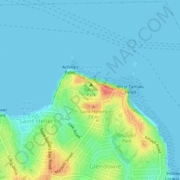
Name: Glover Park topographic map, elevation, terrain.
Location: Glover Park, Saint Heliers, Ōrākei, Auckland, New Zealand (-36.84838 174.86570 -36.84526 174.86985)
Average elevation: 13 m
Minimum elevation: 0 m
Maximum elevation: 65 m
Auckland trails, hiking, mountain biking, running and outdoor activities
Thank you for supporting this site ❤️
Make a donation
Make a donation