
Omanaia topographic map
Interactive map
Click on the map to display elevation.
About this map
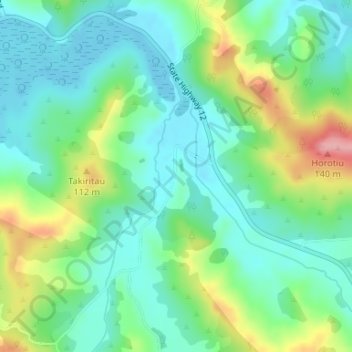
Name: Omanaia topographic map, elevation, terrain.
Average elevation: 39 m
Minimum elevation: 0 m
Maximum elevation: 131 m
Other topographic maps
Click on a map to view its topography, its elevation and its terrain.
Horeke
New Zealand > Kaikohe-Hokianga Community > Horeke
Horeke, Kaikohe-Hokianga Community, Far North District, Northland, 0491, New Zealand
Average elevation: 46 m
Waimate North
New Zealand > Kaikohe-Hokianga Community > Waimate North
Waimate North, Kaikohe-Hokianga Community, Far North District, Northland, New Zealand
Average elevation: 149 m
Awaroa River
New Zealand > Kaikohe-Hokianga Community
Awaroa River, Kaikohe-Hokianga Community, Far North District, Northland, 0496, New Zealand
Average elevation: 62 m
Umawera
New Zealand > Kaikohe-Hokianga Community
Umawera, Kaikohe-Hokianga Community, Far North District, Northland, New Zealand
Average elevation: 309 m
Rawene
New Zealand > Kaikohe-Hokianga Community > Rawene
Rawene, Kaikohe-Hokianga Community, Far North District, Northland, 0452, New Zealand
Average elevation: 8 m
Omapere
New Zealand > Kaikohe-Hokianga Community > Omapere
Omapere, Kaikohe-Hokianga Community, Far North District, Northland, 0444, New Zealand
Average elevation: 68 m
Mangamuka River
New Zealand > Kaikohe-Hokianga Community
Mangamuka River, Kaikohe-Hokianga Community, Far North District, Northland, 0453, New Zealand
Average elevation: 100 m
Waimamaku River
New Zealand > Kaikohe-Hokianga Community
Waimamaku River, Kaikohe-Hokianga Community, Far North District, Northland, 0444, New Zealand
Average elevation: 281 m