
Oudenaarde topographic map
Interactive map
Click on the map to display elevation.
About this map
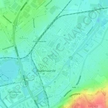
Name: Oudenaarde topographic map, elevation, terrain.
Location: Oudenaarde, East Flanders, Flanders, Belgium (50.83640 3.59816 50.85856 3.62541)
Average elevation: 18 m
Minimum elevation: -2 m
Maximum elevation: 78 m