
Thank you for supporting this site ❤️
Make a donation
Make a donation
Hazel Green topographic map
Click on the map to display elevation.
Thank you for supporting this site ❤️
Make a donation
Make a donation
About this map
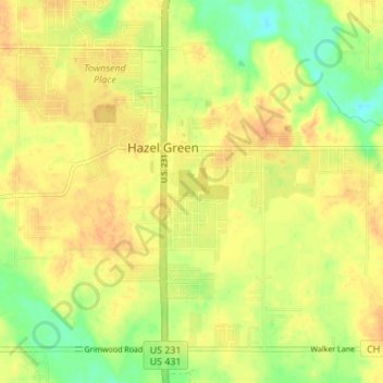
Name: Hazel Green topographic map, elevation, terrain.
Location: Hazel Green, Madison County, Alabama, 35750, United States (34.90228 -86.60053 34.94919 -86.53204)
Average elevation: 239 m
Minimum elevation: 218 m
Maximum elevation: 251 m
Thank you for supporting this site ❤️
Make a donation
Make a donation
Other topographic maps
Click on a map to view its topography, its elevation and its terrain.
Thank you for supporting this site ❤️
Make a donation
Make a donation
Monte Sano Mountain
United States > Alabama > Madison County
The top is relatively flat and lies just under 500 meters above sea level. This elevation is about 300 meters higher than the floor of the Tennessee Valley, which surrounds it. A residential neighborhood occupies the western portion of the top. The eastern portion and slopes of the mountain are occupied by…
Average elevation: 396 m
Thank you for supporting this site ❤️
Make a donation
Make a donation
Thank you for supporting this site ❤️
Make a donation
Make a donation