
Thank you for supporting this site ❤️
Make a donation
Make a donation
Oirschot topographic map
Click on the map to display elevation.
Thank you for supporting this site ❤️
Make a donation
Make a donation
About this map
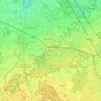
Name: Oirschot topographic map, elevation, terrain.
Location: Oirschot, North Brabant, Netherlands (51.42508 5.19103 51.55282 5.39119)
Average elevation: 17 m
Minimum elevation: 4 m
Maximum elevation: 29 m
Thank you for supporting this site ❤️
Make a donation
Make a donation
Other topographic maps
Click on a map to view its topography, its elevation and its terrain.