Geolocate

Rhosesmor topographic map

Click on the map to display elevation.

About this map

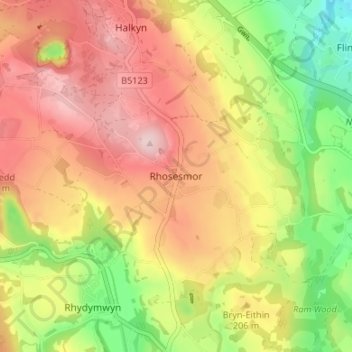
Name: Rhosesmor topographic map, elevation, terrain.

Location: Rhosesmor, Flintshire, Wales, CH7 6WJ, United Kingdom (53.18877 -3.19798 53.22877 -3.15798)

Average elevation: 191 m

Minimum elevation: 60 m

Maximum elevation: 303 m

Other topographic maps

Click on a map to view its topography, its elevation and its terrain.

Point of Ayr

United Kingdom > Wales > Flintshire > Talacre

Average elevation: 2 m

Ewloe Castle

United Kingdom > Wales > Flintshire > Ewloe

Average elevation: 74 m

Penyffordd

United Kingdom > Wales > Flintshire

Average elevation: 101 m

Wepre Park

United Kingdom > Wales > Flintshire > Connah's Quay

Average elevation: 46 m

Saltney

United Kingdom > Wales > Flintshire

Average elevation: 9 m

Bagilt Reservior

United Kingdom > Wales > Flintshire > Bagillt

Average elevation: 32 m

Nannerch

United Kingdom > Wales > Flintshire > Nannerch

Average elevation: 232 m