
Marbach topographic map
Interactive map
Click on the map to display elevation.
About this map
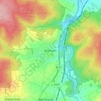
Name: Marbach topographic map, elevation, terrain.
Location: Marbach, Petersberg, Landkreis Fulda, Hessen, 36100, Deutschland (50.60059 9.70484 50.64059 9.74484)
Average elevation: 339 m
Minimum elevation: 261 m
Maximum elevation: 444 m