
Thank you for supporting this site ❤️
Make a donation
Make a donation
Edmond topographic map
Click on the map to display elevation.
Thank you for supporting this site ❤️
Make a donation
Make a donation
About this map
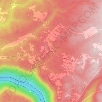
Name: Edmond topographic map, elevation, terrain.
Location: Edmond, Fayette County, West Virginia, 25837, United States (38.04233 -81.04732 38.08233 -81.00732)
Average elevation: 596 m
Minimum elevation: 266 m
Maximum elevation: 720 m
Thank you for supporting this site ❤️
Make a donation
Make a donation
Other topographic maps
Click on a map to view its topography, its elevation and its terrain.