
Ahuriri Estuary topographic map
Interactive map
Click on the map to display elevation.
About this map
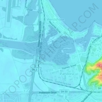
Name: Ahuriri Estuary topographic map, elevation, terrain.
Average elevation: 4 m
Minimum elevation: -3 m
Maximum elevation: 81 m
Hawke's Bay trails, hiking, mountain biking, running and outdoor activities
Other topographic maps
Click on a map to view its topography, its elevation and its terrain.