
Herbetet topographic map
Interactive map
Click on the map to display elevation.
About this map
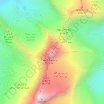
Name: Herbetet topographic map, elevation, terrain.
Location: Herbetet, Cogne, Valle d'Aosta, Italië (45.54456 7.27376 45.54466 7.27386)
Average elevation: 3,243 m
Minimum elevation: 2,810 m
Maximum elevation: 3,835 m
Other topographic maps
Click on a map to view its topography, its elevation and its terrain.
Torre del Gran San Pietro
Italië > Valle d'Aosta > Cogne
Torre del Gran San Pietro, Cogne, Valle d'Aosta, Italië
Average elevation: 3,135 m
Roccia Viva
Italië > Valle d'Aosta > Cogne
Roccia Viva, Cogne, Valle d'Aosta, Italië
Average elevation: 3,055 m