
Thank you for supporting this site ❤️
Make a donation
Make a donation
Fort Hall topographic map
Click on the map to display elevation.
Thank you for supporting this site ❤️
Make a donation
Make a donation
About this map
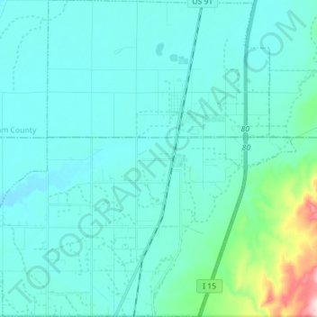
Name: Fort Hall topographic map, elevation, terrain.
Location: Fort Hall, Bannock County, Idaho, United States (42.96376 -112.52611 43.06658 -112.38545)
Average elevation: 1,377 m
Minimum elevation: 1,335 m
Maximum elevation: 1,691 m
Thank you for supporting this site ❤️
Make a donation
Make a donation
Other topographic maps
Click on a map to view its topography, its elevation and its terrain.