
Thank you for supporting this site ❤️
Make a donation
Make a donation
Knutsford topographic map
Click on the map to display elevation.
Thank you for supporting this site ❤️
Make a donation
Make a donation
About this map
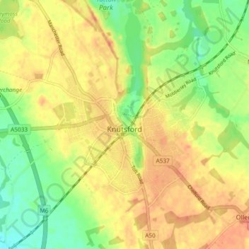
Name: Knutsford topographic map, elevation, terrain.
Location: Knutsford, Cheshire East, England, United Kingdom (53.28683 -2.40610 53.31990 -2.33256)
Average elevation: 57 m
Minimum elevation: 33 m
Maximum elevation: 75 m
Thank you for supporting this site ❤️
Make a donation
Make a donation