
Røros topographic map
Interactive map
Click on the map to display elevation.
About this map
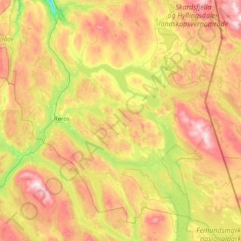
Name: Røros topographic map, elevation, terrain.
Location: Røros, Trøndelag, Noruega (62.30989 11.12454 62.82916 12.25467)
Average elevation: 844 m
Minimum elevation: 396 m
Maximum elevation: 1,550 m
Other topographic maps
Click on a map to view its topography, its elevation and its terrain.