
Thank you for supporting this site ❤️
Make a donation
Make a donation
Zumpango topographic map
Click on the map to display elevation.
Thank you for supporting this site ❤️
Make a donation
Make a donation
Zumpango
About half of the territory is flat, mostly in the south with hills and small mountains in the north. The highest elevation is the Cerro del Zitlaltepec at 1650 meters above sea level. The main surface water is Lake Zumpango, which extends over 2,000 hectares. There are also some seasonal streams, the Gran Canal and other tunnels dug to drain the Valley of Mexico.
Thank you for supporting this site ❤️
Make a donation
Make a donation
About this map
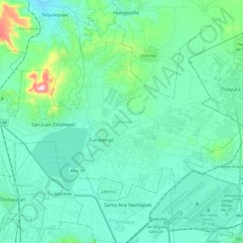
Name: Zumpango topographic map, elevation, terrain.
Location: Zumpango, State of Mexico, Mexico (19.72170 -99.19358 19.90413 -98.97020)
Average elevation: 2,276 m
Minimum elevation: 2,198 m
Maximum elevation: 2,703 m
Thank you for supporting this site ❤️
Make a donation
Make a donation