
Thank you for supporting this site ❤️
Make a donation
Make a donation
Ogawara topographic map
Click on the map to display elevation.
Thank you for supporting this site ❤️
Make a donation
Make a donation
About this map
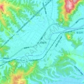
Name: Ogawara topographic map, elevation, terrain.
Location: Ogawara, Shibata County, Miyagi Prefecture, Japan (38.02249 140.67664 38.07666 140.75360)
Average elevation: 40 m
Minimum elevation: 5 m
Maximum elevation: 212 m
Thank you for supporting this site ❤️
Make a donation
Make a donation