
Jinjeop topographic map
Interactive map
Click on the map to display elevation.
About this map
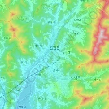
Name: Jinjeop topographic map, elevation, terrain.
Location: Jinjeop, Namyangju-si, Gyeonggi, South Korea (37.66410 127.14121 37.76847 127.26143)
Average elevation: 192 m
Minimum elevation: 28 m
Maximum elevation: 738 m