
Thank you for supporting this site ❤️
Make a donation
Make a donation
Burgess Hill topographic map
Click on the map to display elevation.
Thank you for supporting this site ❤️
Make a donation
Make a donation
About this map
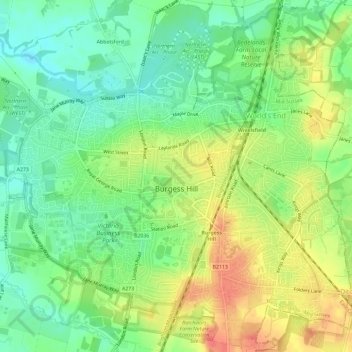
Name: Burgess Hill topographic map, elevation, terrain.
Location: Burgess Hill, Mid Sussex, West Sussex, England, United Kingdom (50.94034 -0.15936 50.97726 -0.10422)
Average elevation: 40 m
Minimum elevation: 16 m
Maximum elevation: 71 m
Thank you for supporting this site ❤️
Make a donation
Make a donation